
GNSS RFI
Monitoring
SecureTrack provides integrated airspace and ground GNSS RFI monitoring that gives operators situational awareness for navigation reliability across the airspace.
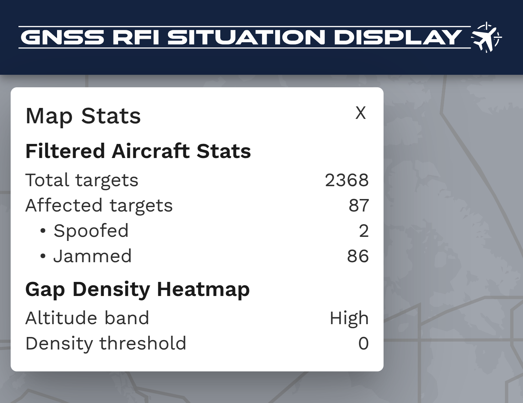
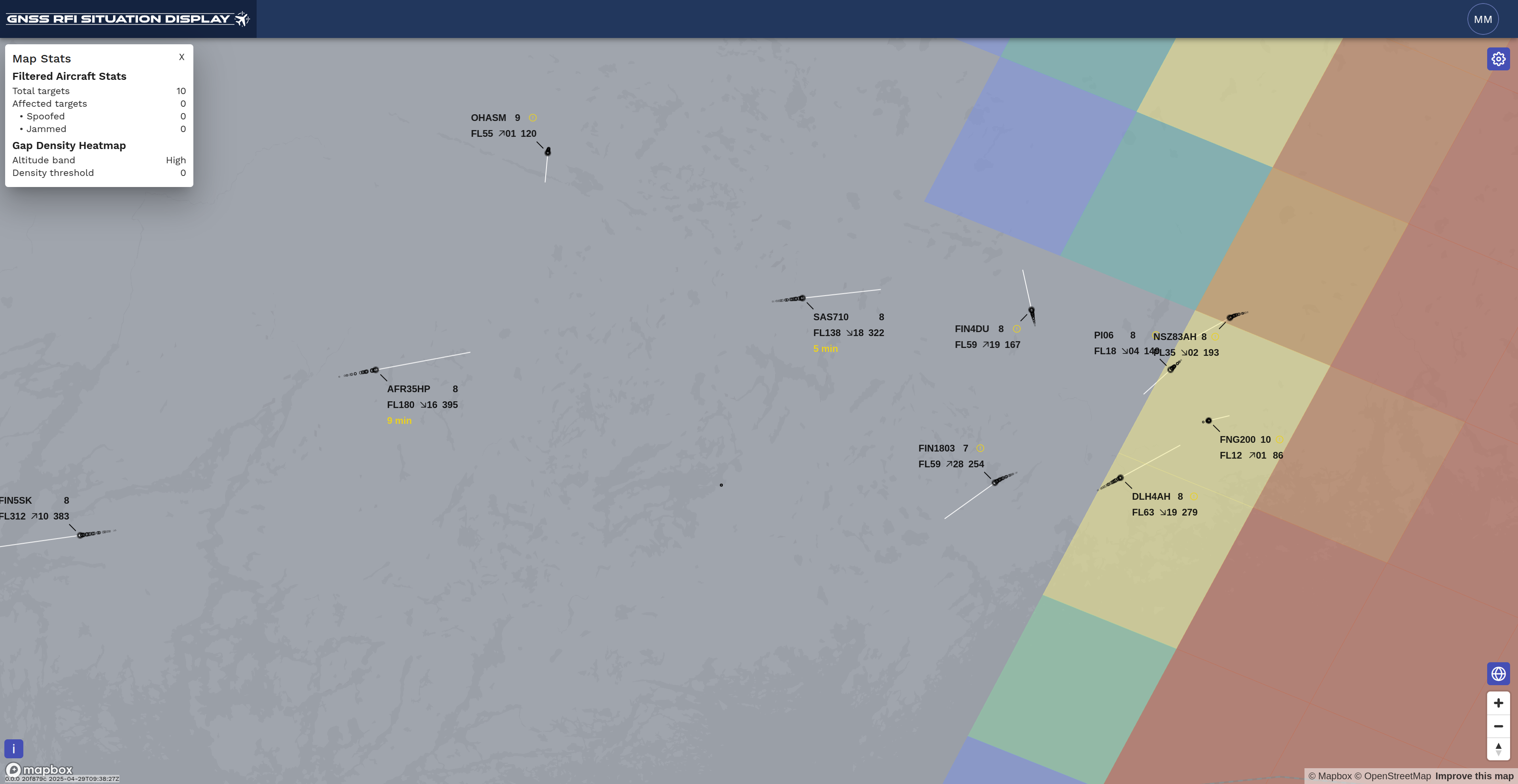
Airspace GNSS RFI monitoring uses ADS-B position reports and multilateration-derived aircraft positions to identify aircraft affected by corrupted GNSS signals, while ground-based monitoring detects jamming and spoofing at airports and critical infrastructure. Real-time alerts notify operators when aircraft are affected by jamming or spoofing, enabling rapid response and improved situational awareness.
Ground GNSS signal measurements cover multiple constellations (GPS, GLONASS, Galileo, Beidu) and multiple frequencies (e.g., the GPS L1, L2, and L5 frequency bands). Our control-room interface provides real-time situational awareness of GNSS interference conditions across the monitored environment.
SecureTrack provides ICAO Annex 10 Vol. 1-compliant GNSS performance recording and historical data analysis across air and ground monitoring environments to support investigation, reporting, and regulatory requirements.

Key Features
- Spoofing detection visualization: Identify affected aircraft and spoofing origin
- GNSS RFI intensity heatmap: Assess interference severity across airspace
- RFI statistics module: Create charts, tables, and affected-flight analysis
- Internal GNSS chip data views: Satellite visibility and signal-strength charts
- Ground monitoring module: Increased visibility of the GNSS environment at receiver-level
- Multi-constellation multi-frequency (MCMF) support: Ground monitoring covers all relevant constellations and frequency bands.
- Frequency spectrum (FFT) visualization: Identify interference peaks
- Waterfall charts: Visualize time-varying GNSS interference
- Flight analytics tools: Investigate GNSS interference
- Customizable filters: Advanced filtering and reusable filter profiles
- CSV / KML export and map overlays: Detailed investigation and reporting
- Extensive data export and alerting capabilities: Enabling comprehensive situational awareness and reporting

.png)

